Bird Migration Movements Seen Using Radar Satellites
|
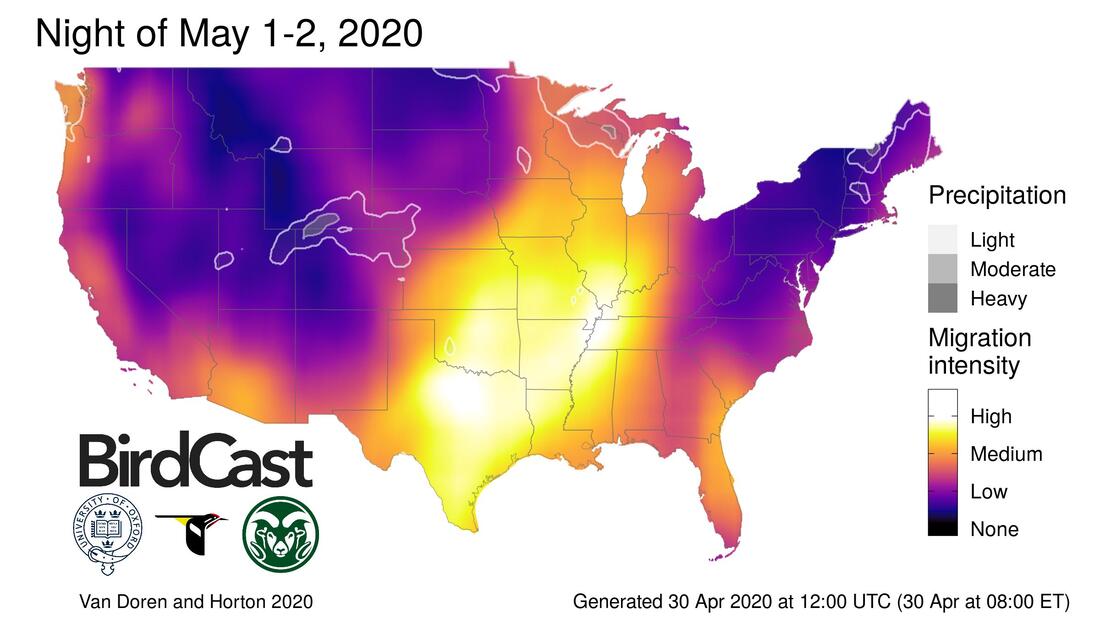
For many years bird researchers have been able to use weather satellite data to also watch for bird migrations. Because during migration millions of birds are on the move, often especially at night, they produce enough matter in the air to show up on radar, and scientists have learned how to differentiate birds from precipitation. The BirdCast web site provides lots of really cool reports, predictions, and live and recent videos of migratory bird movements in the United States. You can see the color codes used to indicate how heavy the migration was in a specific period of time. There was little last night in our mid-Atlantic area, but it was very heavy from Texas to the Great Lakes!!
|
|
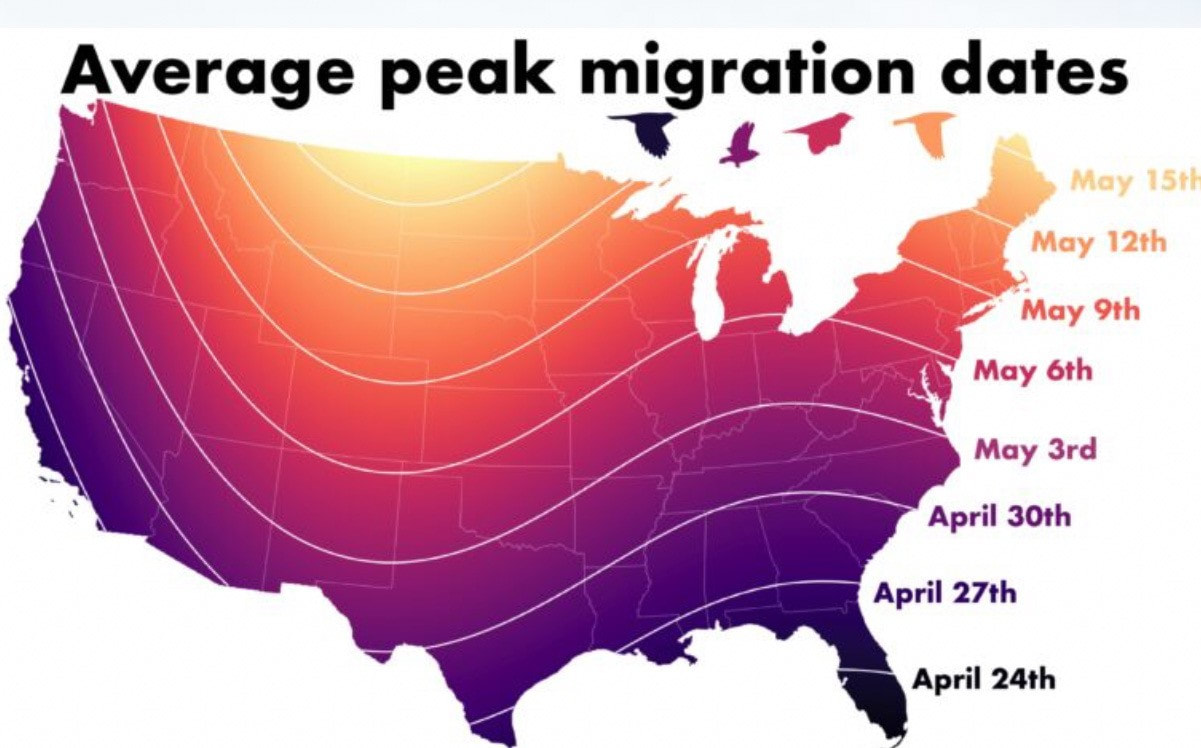
The graphic below shows average peak migration dates. Our peak is around this week, but spring migration occurs over a few months.
I captured some videos (below) from last week comparing radar migration data from 6PM-1 AM April 25-26 and April 27-28. As you can see, we had many more birds move into our area the night of the 27- 28th! Generally l speaking, overall weather and wind direction and speeds greatly influence bird migrations.
|
|
|
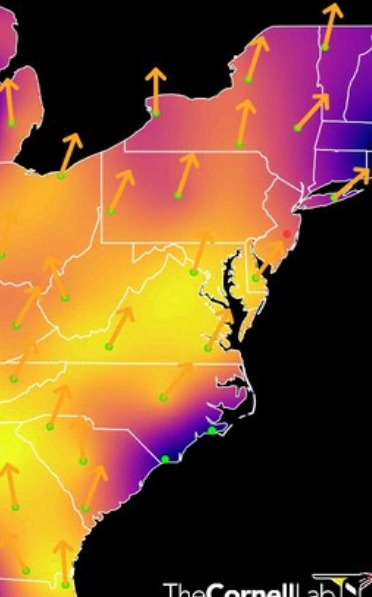
Below left is a graphic showing the prediction for tonight (good for our area), and below that map are three smaller maps, showing tonight, and the next two nights (click on the night you want to see). On the right is a zoomed in view of east coast migration from the April 28th video.

|
|